Three best navigation programs for iPhone and iPad. The best navigator for iPhone: review and reviews
I have long wanted to start a series of articles in which I will review ultra-useful applications for the iPhone. I value my audience and always share with you the most valuable and useful things that I know. Today I will tell you about the best, in my opinion, free GPS navigator for iPhone, which I use every time I find myself in an unfamiliar city. The application is called maps.me and I am ready to bow deeply to its developers for the work they have done. So why is maps.me a special app? I'll tell you now!
As you already understand, today we will talk about a GPS navigator for iPhone, which falls into the section MUST HAVE for your iPhone. Download maps.me you can follow this link.
Let's look at all its functions in order, but let's start from the very beginning - installation.
Step 1 Installing maps.me is NOT different from any other application from App Store. Follow the link above and feel free to install it on your iPhone.
Step 2 Uploading cards. This is where the fun begins. maps.me uses maps OpenStreetMap, which are located somewhere on a server on the Internet and are open for free access and editing. It is this small nuance that makes the maps.me application work and at the same time free GPS navigator for iPhone ( just what we need). So, without diverting from the topic... Maps are open for free downloading from the Internet, and this is done directly from the program interface. You can download maps of your region, sometimes a city, or the entire country at once. The whole world is available! To access the map download menu, click on the right icon in the bottom line (three horizontal bars), and then on “ Download maps". Everything is clearly visible in the screenshots below. 
Step 3 Card management. On the page “ My cards” you can Download, Delete or Update already downloaded maps. Oh, by the way, the maps are updated periodically, so don’t forget to check them on this page. 
Step 4 Navigation. If the required map has already been downloaded, you can zoom to that area, city, street even without access to the Internet and mobile network. For example, while driving around Greece by car, I turned on airplane mode, completely cutting off communication with mobile network... and everything worked great. 
Step 5 Planning a route. Let's now try how maps.me works as a navigator. Let's say we need to plot a route from Fiumicino airport to Colosseum in the center of Rome. To do this, click on the starting point on the map (1)
and at the bottom of the screen click “ From here” (2)

After that, find and click on the destination point (3)
and press “ Here” (4)

The program will plot the optimal route, taking into account the chosen means of transportation (car, bicycle, foot). After which all you have left is Begin following a route, during which the program will voice prompt you about upcoming turns. 
But it is not necessary to use this application as a navigator; very often I just look through the streets and alleys to understand where I am and where to move in an unfamiliar place. To do this, just enlarge (zoom in) the map with two fingers and simply move it around your location.
MAPS.ME is truly a magical application, but not without its shortcomings. I consider the main ones to be the following:
* It is not possible to add intermediate points to the route
* Not all cities display house numbers
*No routing option for public transport
* There are no warnings about traffic jams and congestion on the road
But despite the listed disadvantages, this application has three main advantages: free use, availability of maps of the whole world, possibility of using off-line. These advantages cancel out all the disadvantages, and make maps.me best offline navigator for iPhone.
- How to download music to iPhone -
- How to copy photos from iPhone to computer -
If I haven't convinced you yet, go ahead and try it yourself. The application is really worthwhile and if you even sometimes travel outside your city, you simply need it. Don’t think that this little review was paid for... no, I’m not like that (well, maybe sometimes a little bit). Starting from this article I am adding to the site new tag “bestapps”, by clicking on which you can find a lot useful applications, the existence of which you have not yet guessed. If you use any application that you can’t “imagine your existence” without, share with us in the comments and I will definitely write a review article for everyone else.
Readers also like:
Repairing sticky and jammed buttons MacBook Air do it yourself - Lesson No. 5
This iPhone has a limited number of free accounts activated [Re...
A high-quality navigator will be a good companion for any long journey. And the most interesting thing is that nowadays it is no longer necessary to buy separate device for navigation, you can simply install a special software into your Apple tablet. IN lately A navigator without the Internet for iPad is gaining popularity. Let's look at the most popular of them.
Navigators working offline
In the Apple store you can find a huge number of navigation utilities that have high ratings and, according to user reviews, work perfectly and without failures. Among them are NAVITEL, Yandex.Navigator, CityGuide, CoPilot. You can download the navigator for iPad in the same App Store.
NAVITEL
This program has been on sale for a long time and is well known among owners of Apple tablets. Offers excellent navigation and maps are available through subscription. And what is important - not only for most regions of the CIS countries, but also for Europe. The utility is often updated by developers and contains a huge number of POIs. Among the shortcomings, users note the poor interface. This navigator for iPad has the following advantages:
- high-quality performance of basic functions;
- Internet access is not required.

Yandex. Navigator
The application is free. The main advantages can also be noted:
- high-quality maps are available, quickly shows the traffic situation, you can control it by voice and it is possible to download maps to the device’s memory;
- plans a route taking into account the actual situation on the road;
- provides information about speed limits on different sections of the road;
- provides data on traffic jams, accidents, repair work;
- shows the time remaining to the final destination of the route.
You can also download Yandex.Navigator for iPad in the Apple store. Among the disadvantages, it is advisable to have a constant connection to the Internet, since the information that it displays very often depends on data received from other drivers in real time. 
CityGuide
One of the fastest navigation utilities - it loads quickly and works. Support for OpenStreetMap maps is available. CityGuide is a good navigator for iPad without the Internet. 
The program can use paid and free paid cards to navigate from different developers, quickly build a route taking into account traffic jams, receive warnings about dangers on the roads.
CoPilot
The program can be downloaded for free with subsequent addition of paid functions, or for a certain amount of money you can install it immediately from a large number options. Works great without a network connection, maps are always loaded onto the device in their entirety. 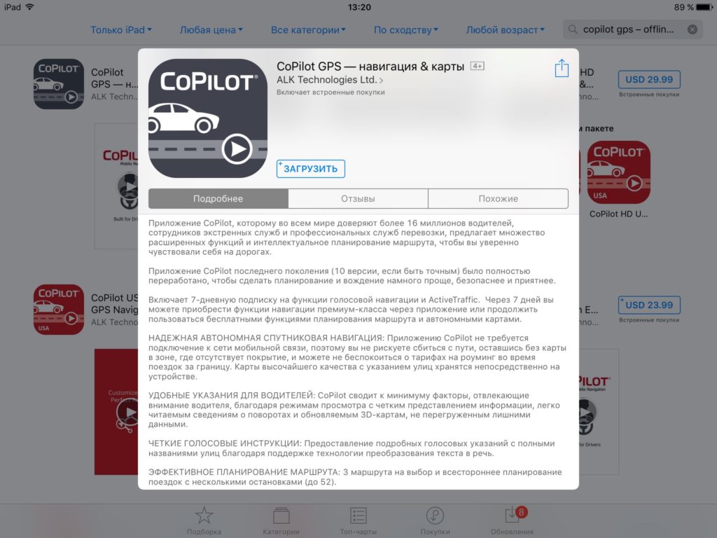 Among the advantages can be noted.
Living in a more or less large populated area, it is very difficult to do without navigation tools. What can we say if you live in a metropolis. That's why you should definitely have one of the navigation apps for your iPhone on hand.
One of the first navigators for smartphones to implement offline maps, so you don’t have to go to the Internet to find point B. But 2GIS is not easy mobile cards, it is also an extremely informative reference book, comparable to the Yellow Pages. Find a nearby place to eat? No problem. Moreover, if you want to book a table, in 2GIS you will find out not only the address, but also the opening hours, as well as contact information.

The peculiarity of the application is that the first time you launch it, you will in any case need to download offline maps for your city, that is, 2GIS simply does not work online. When building a route, 2GIS takes into account how you will get there: on foot, by car public transport, taxi or personal car. For each case, one or more shortest possible routes will be selected.
Yandex.Maps
And if 2GIS allowed you to work with offline maps from the very beginning, then in Yandex.Maps this opportunity appeared quite recently. But this does not make the application worse, since thanks to the ability to work online we receive a lot of useful information. For example, if you are moving on ground transport, it is important to know the current condition of the roads. The application will show the level of traffic congestion on your route and, if necessary, select a route to avoid traffic jams.

As in the case of 2GIS, the route is formed based on how you plan to get there. Moreover, if you want to take a taxi, you can immediately see the cost of the trip from the application, and also call Yandex.Taxi literally in one click. And when getting to your destination for the first time, you will certainly be pleased with the opportunity to virtually walk through the city streets using the function "Augmented Reality".
Yandex.Navigator
If Yandex.Maps is a universal application for creating any type of routes, searching for organizations, viewing their operating hours and contact information, then Yandex.Navigator is indispensable assistant for motorists. Arrive at your destination as quickly as possible optimal route It’s not difficult - all you have to do is follow the prompts on the navigator maps. And so that you don’t miss the right turn, the auto-informer will tell you in advance where you should go.

The capabilities of Yandex.Navigator can be listed for a very long time, here are just the main ones: speed control (you can set your own parameters), notification of speed cameras, display of traffic jam levels, offline work, "Talkers", where drivers can share information about road conditions in specific areas. A nice bonus there will be different voices for the informant, for example, recently users became available opportunity hear tips from Darth Vader, Optimus Prime, Master Yoda and many other famous characters. If you have a car, then this navigator must be installed.
Navitel Navigator
Next up is another car navigator for iPhone. If you are an experienced motorist, then you have probably heard about such a well-known company as Navitel, whose maps were once installed on almost every navigator. If we talk about the application for the iPhone, here the developers pay attention to the interface at the last moment, which cannot be said about the functionality.

For example, the most significant advantage of Navitel is its coverage area: if you are an avid traveler, you will be pleased with the fact that it works great throughout Europe, Asia and America, and the navigator operates offline (but you should take into account the impressive weight many cards). Among other possibilities it is worth highlighting convenient search important organizations, displaying traffic levels, providing detailed weather forecasts, speed control, and searching for and adding friends.
Google Maps
One of the most significant services Google are Cards. If previously the Google application was much inferior to the Yandex solution (largely due to the low detail of the maps even in large cities), now they are approximately equal, but Google has several notable options that its competitor does not have.

For example, during long-term use Google Maps, you will probably be interested in reviewing the places you have visited. If you need your loved ones to know where you are at the moment, activate the geodata transfer function. No internet access? No problem! Just download offline maps first and use them at any time, wherever you are.
MAPS.ME
An indispensable app for travelers. When you decide to visit a new country, do not forget to download the region you need in order to use MAPS.ME without access to the Internet.

Among the main features of MAPS.ME are the selection of entertainment in the selected region, the formation of routes (unlike other mapping applications for the iPhone, there is the ability to create bicycle routes), a convenient search for establishments by category, instant saving of placemarks, sending the current location to friends and much more. other.
Each of the presented iPhone applications has detailed and constantly updated maps, but at the same time, they are very different, having their own unique capabilities. We hope that with our help you were able to find the ideal offline cards for yourself.
Determining the main criteria is not as simple as it seems at first glance. I want everything at once, but in reality it turns out that everything is not as rosy as I would like.
Apple Maps
Our first “experimental” – standard application from Apple. It feels like it “burns” the battery less than others, since it turns on the display only in those moments when you need to turn or perform some action on the road. Continues working even on a locked screen. It has voice prompts in Russian, which is nice.
Of the minuses, it is worth noting the quality of the proposed routes. Although it lines the road correctly, it does not take into account any traffic jams, repair work or accidents. Although the maps themselves use Yandex services, I still haven’t noticed much of their influence.
Google Maps
Cards from the “good corporation”. The application can speak Russian, and it turns on in the same way if necessary if the screen is locked, but it is not implemented so conveniently - a notification simply appears on the screen indicating where you need to go. In addition, traffic jams are also shown, but the information about them is often not entirely accurate.
Can be used quite well in conjunction with Google Now(aka Google Search) on your iOS device.

2GIS
A huge database of various objects in the city. Has information on almost every house in the city (of the supported ones, of course). Finding the right building, organization or address is extremely easy, as is getting directions to it. For some objects, you can even see information about which entrance you need to drive up to in order to get exactly where you were going.
It shows traffic jams, but not for all streets, mostly only main roads. He can’t talk at all, and as a navigator he’s not entirely convenient, functional or beautiful.

Yandex.Maps
Perhaps one of the most informative services in the App Store. Information about the state of the roads regarding traffic jams, cameras, road works and accidents is updated quite quickly. In addition, it has a so-called “people's card”, using which you can see comments and tips left by users of the service, which is sometimes very useful.
He can’t talk, because he doesn’t seem to be a navigator at all. It has an inconvenient interface in which it is not even possible to rotate the map. It can be used as an application that allows you to calculate the route, but driving with its help is extremely problematic. Although it seems to me that the vast majority of drivers still use cards from Yandex, so as not to bother with alternatives.

Yandex.Navigator
What Yandex.Maps should be like. Can do everything that he can previous application, with the only exception that he looks good (almost perfect with the recent update) and can talk. The same functionality is supported: traffic jams, road events and the “people's map”.
Unfortunately, according to tests, it does not lay out parts of the routes that other navigation applications offer. Usually finds two out of three of these. But it’s quite convenient. As a bonus, it can determine the destination “by ear.” To do this, instead of entering the address from the keyboard, you can simply dictate it.

Navitel and CityGuide
It’s not for nothing that I combined these two applications. It seems that they were developed by the same people, since the “illnesses” are the same for both: constant problems with licenses/activation, an overloaded and completely inconvenient interface, extremely rare updates and a high price. Perhaps they work well as a separate navigator in the car, and not as an application (although, according to rumors, everything is just as bad). On the plus side, we can note... nothing.


PROgorod
This navigation service came to hand completely by accident. I had no idea about its existence before. I decided to try it and was pleasantly surprised.
It can talk and warn not only about turns/U-turns, but also about school zones, cameras and speed bumps. At the right moment, it will tell you which side is best to stick to and will clearly show which lane to move in in order to turn correctly. It shows traffic jams and road events quite adequately, at least no worse than Yandex.
Among the disadvantages, it is worth noting the ugly interface, similar to previous representatives, is too overloaded and not intuitive. But as a navigator, perhaps the best of all. - these are, of course, standard apple cards, which soon (I really hope) will work adequately in Russia. Left only because they cannot be removed.
– 2GIS. As a useful source of information about the city, in which it is very convenient to search for the necessary addresses/telephone numbers/locations.
– Yandex.Navigator. As the main system for navigation. In conjunction with user tips, this is quite a good solution.
- PRO-City. I am currently actively testing it before deciding to purchase. The license is not cheap (about 1,200 rubles), so it is better to identify all the “jambs” in advance, especially since for the first 30 days the application can be used absolutely without restrictions. And if this time is not enough, then for “like” on Facebook or VKontakte you will be given the same amount of time to continue testing. Perhaps, if I decide, it will take the place of the navigator from Yandex. For now, that's it.
Of course, there are other navigation systems, but nothing else came across anything worthwhile. Maybe you can tell me if you yourself use similar applications, and if so, which ones?
Navigators for iPhone have flooded the appstore, and you don’t know which one to download to your phone? Which navigator for iPhone 5 should you install?Is it possible to find a better navigator for iPhone? You will find answers to these questions in this article. I'll tell you everything important points, which are worth considering when choosing a navigation application.
Many of you have probably already heard about such navigation systems as CityGuide, Navitel, Garmin. And I’m even sure that you managed to try them. Personally, in my opinion, I would not install any of these applications, and I will try to explain my point of view in this article.
Is it worth installing CityGuide, Navitel on iPhone?
I definitely think there is no need to install these apps. Each of them has its own pros and cons. Almost every application has the ability to use offline maps, as well as free version navigation system with certain limitations.
Navitel for iPhone pros and cons.
The advantages are probably that this is a fairly well-known company that, in addition to its navigation system, offers free online services such as: Traffic, friends, events, SMS and weather. Everything else is absolutely no different from competitors. Please note that Navitel offers its application for free in the App Store, but there is no point in using this application if you have to pay for cards. But I can please you: within 30 days, you can try all the features of the program for free.
And so, downloading map updates is unrealistic, even if your high speed internet, the download will be at a speed of 20 kb per second. The map of Moscow is old and there have been no normal updates for a long time. Graphic design leaves much to be desired, the route planning sometimes slows down or takes some detours. In some cities, houses are not displayed, only roads.
Total: It’s better not to install Navitel oniphone.
CityGuide for iPhone pros and cons.
In principle, the CityGuide navigation system is worthy of attention, as it is a level higher than Navitel. Very pleased voice function with warnings about various situations on the roads, for example, about dangerous potholes, sharp turns, traffic police ambushes and accident sites. It is also possible to receive various changes on the roads, such as road closures, turn bans, all of this is sent automatically.
However, there are constant problems with the license here: the key is lost, the cards are not installed, after the update the search for an address in St. Petersburg disappeared. The purchased maps will disappoint you with the lack of houses and the inability to get directions. Technical support will ignore your questions even if you pay money. It also periodically shows the route and location incorrectly.
Total: You can install CityGuide if you are ready to accept the shortcomings. Personally, I didn't install it.
In general, if we talk about navigation apps presented above, you should understand that their maximum goal is to get more of your money: paid cards, paid subscriptions etc.
So I decided to go deeper in my search and find a really high-quality navigator for the iPhone. I will say right away that at some point I already wanted to give up this idea, because my requests for the navigation system are quite strict, but at the last moment several applications still made me happy, and I use them with great pleasure.
Choosing the best navigator for iPhone
MapsWithMe is one of my favorite navigators for iPhone. Because this application always contains detailed and up-to-date data, maps of any country can be downloaded for free directly from the application, the program can work without an Internet connection, which means you don’t have to spend money on roaming and use navigation where there is no network. A navigation program for iPhone called MapsWithMe even contains remote villages and towns on its maps.
MapsWithMe is the best walking GPS navigator for iPhone?

I'll tell you with my own example. Before going on a trip to Europe, I downloaded the GPS navigator MapsWithMe on my iPhone 4s. In 40 minutes I downloaded all the necessary countries that I was going to visit: Finland, Sweden, Estonia, Norway, Russia. I had never been anywhere other than Russia before, so I couldn’t even imagine what awaited me. But once I found myself in any of the listed countries, I easily found my way around without the help of a guide.
The program shows the nearest cafes and restaurants, game parks, shops, banks and ATMs. I also really liked the “Guide” function, which shows historical places and gives interesting and interesting information about them. useful information. It is also convenient to set drop-off points, for example a ferry or an airport, and then get there without any problems. Maps are optimized, load quickly, scale, and their size varies from 10 to 150 MB.
However, there are also disadvantages to this navigation system, at the time of writing in this application There is no route planning. However, I still recommend installing this application, especially if you like to sometimes go to other countries or cities without a car. For pedestrian navigation, this program is simply a bestseller.
Now let's look at the best car GPS navigator for iPhone?

In the App Store it is called: “GPS navigation” from the company Skobbler, and in my opinion this is the best navigator I have ever tried. I was very pleased with the “Voice Navigation”, which reports everything, including the speed limit on a given section of the road, the nearest exit, turn, traffic police radars, etc. Maps works in both versions, if you do not have maps, then it is downloaded Online via the Internet, if you have downloaded maps, then the Internet is not required. Very high-quality route planning, leading along the shortest routes. In St. Petersburg, it easily identifies roundabouts, exits from the Ring Road, and back. He also sees all the changes and new roads. Very fast application, clear location determination, high-quality navigation and zoom. You can view both 2D and 3D maps.
Independent navigator for iPhone.
Likewise, on different cases, I keep Yandex Navigator on my iPhone, it can plot a route taking into account traffic jams, in addition, it shows traffic jams and accidents on the roads. He has no other particularly important merits, but sometimes he helps out. In addition, Yandex navigator is free application, which anyone can install. During my work, I noticed a small drawback in this navigator: when driving a car along the highway, the beacon goes off the road and it seems as if you are driving on the side of the road. Overall, it's a good app.
Let's summarize. Which navigator should I install on my iPhone?
Personally, few people will like my opinion, but I suggest installing all three options: MapsWithMe, Yandex Navigator and GPS navigation from Skobbler. It's just a great option to keep with you. navigation system for different situations.
MapsWithMe-should be installed only if you like to travel and walk rather than drive.
Application "GPS navigation" from Skobbler should only be installed if you need voice accompaniment, as well as voice assistance about speed limits, obstacles, traffic police radars. And also if you prefer to use GPS navigation in Offline mode without the Internet.
If everything said above does not bother you, and you just need route planning without any voice gadgets and amenities. That Yandex Navigator will be an excellent companion for you in all road matters.